Zanzibar Island covers about 1,666 square kilometres, running roughly eighty five kilometres north to south and thirty kilometres across at its widest. Driving from one end to the other takes around two hours. The island is properly called Unguja and is the largest in the Zanzibar Archipelago, a semi autonomous part of Tanzania in the Indian Ocean.
The number matters less than what it means in practice, which is that everything is close together and nothing is quick.
Zanzibar Island’s Dimensions and Area
Unguja measures approximately eighty five kilometres from its northern tip at Nungwi to the southern coast near Kizimkazi, and about thirty kilometres east to west at its broadest point. Total land area is roughly 1,666 square kilometres, or about six hundred and forty three square miles.
Some references quote a slightly lower figure of around 1,554 square kilometres and a width closer to thirty nine kilometres, depending on whether the surrounding islets are counted and where the coastline is measured. The difference is not material for anyone planning a trip.
The shape is roughly oval with a long tapering south. The northern half is broader, the coastline is heavily indented on the western side and smoother on the east, and a scatter of smaller islands sits offshore.
Do not plan around the map. Eighty five kilometres of island translates into two hours of driving from north to east, because the roads run back through the middle rather than around the coast.
How Zanzibar’s Size Compares With Other Islands
Against Greater London. Unguja is slightly larger, at around 1,666 square kilometres against roughly 1,570. An island the size of a major city with under a million people on it.
Against Pemba. The archipelago’s second island covers about 988 square kilometres, a little under two thirds the size of Unguja, and holds a population of around 543,000.
Against Mauritius. Mauritius is slightly larger overall and considerably more mountainous. Unguja is flat by comparison and has a longer coastline relative to its area.
Against the Serengeti. The mainland park covers close to fifteen thousand square kilometres, nearly nine times the whole of Unguja. Worth remembering when planning a combined trip.
The Terrain and Elevation of Zanzibar Island
Unguja is low lying. There are no mountains, no rivers of any size and very little relief, with the highest ground rising to under two hundred metres along a low ridge running through the centre near Koani. Some sources put the highest point at around a hundred and twenty metres, others closer to a hundred and ninety five.
Most of the island sits on coral rag, a hard fossilised reef limestone with thin soil over the top. That is why the eastern interior supports scrub, coconut and cassava rather than dense agriculture, and why the ground underfoot at Jozani and around the caves is so uneven.
The western belt has deeper soils, which is where the clove and spice farms sit and why the historic wealth of the island concentrated on that side. Groundwater forest survives at Jozani in the southeast, and mangrove fringes much of the eastern and southern coast.
The absence of high ground has one practical consequence worth knowing: there is nowhere on the island to escape the heat by going up.
How Long It Takes to Drive Across Zanzibar
This is the size question that actually affects a trip.
From the airport or Stone Town on the western promontory, allow fifteen to twenty minutes into the old town, about an hour east to Paje and Jambiani, an hour to an hour and a quarter northeast to Matemwe, an hour and a half north to Nungwi and Kendwa, and an hour and a half south to Kizimkazi.
Crossing directly between coasts takes longer than the distance suggests. Nungwi to Paje is a good two hours, because the route runs back inland rather than around the shore.
The reason is the roads rather than the distance. They are narrow, villages sit directly on them, and traffic moves at the pace of the slowest vehicle. Speed averages well below what a European road of the same length would allow.
An island small enough to cross in a morning, on roads that make it an afternoon as well.
Coastline, Reefs and How Much of Zanzibar Is Edge
For an island of this size, Unguja has a great deal of coast, and that ratio is a large part of why it works as a beach destination.
The western side is heavily indented, with creeks, bays and mangrove inlets, which is where the natural harbours are and why Stone Town grew on that shore. The eastern side is far smoother, running in long uninterrupted stretches from Matemwe down through Kiwengwa, Pongwe, Bwejuu, Paje and Jambiani to the southern tip.
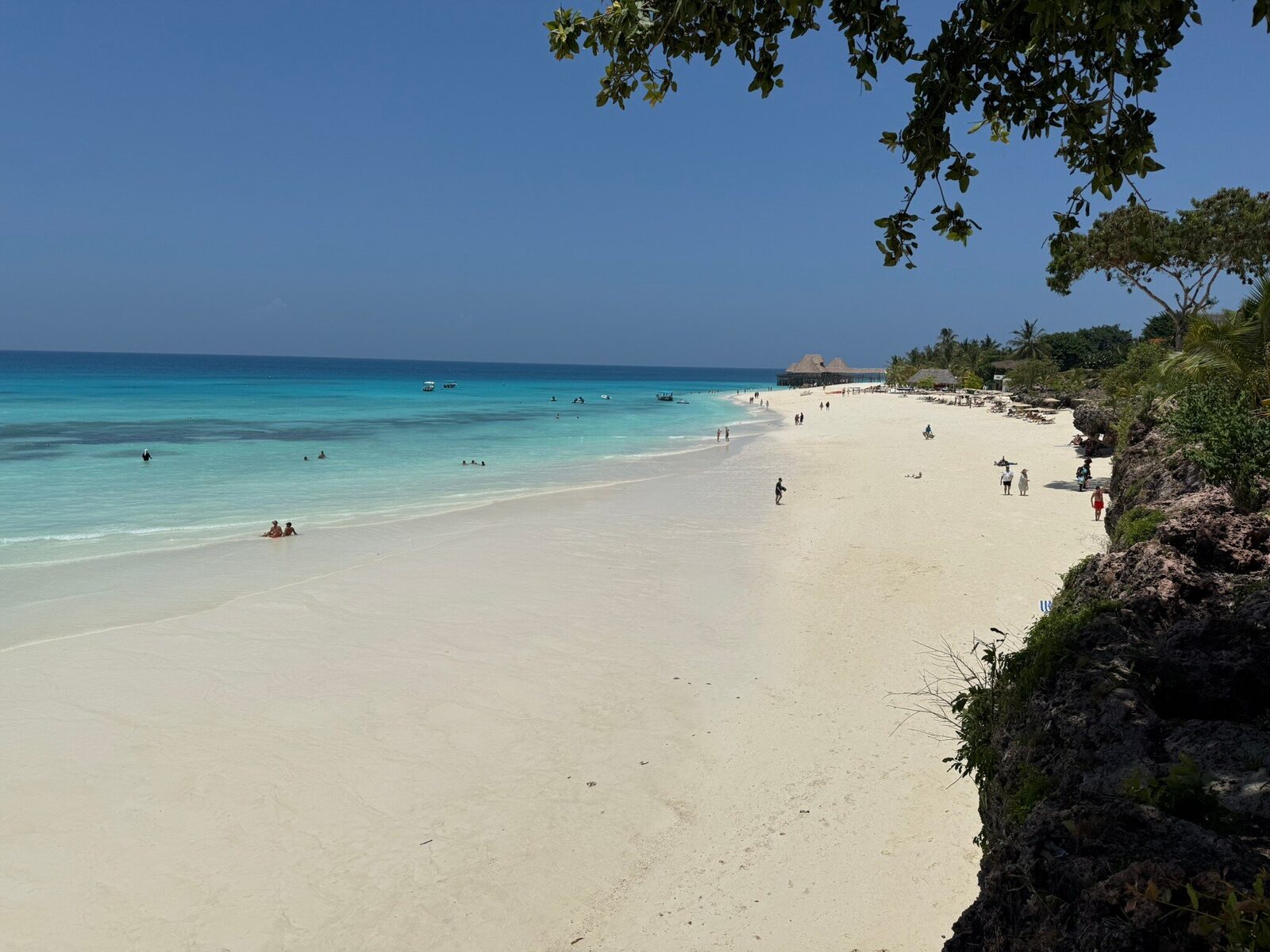
Fringing reef runs along most of the eastern and southern coast a short distance offshore, which is what creates the shallow lagoons and the enormous tidal range on that side. The north coast at Nungwi and Kendwa sits outside that system, which is the single most useful geographical fact on the island for anyone booking a hotel.
Chwaka Bay cuts deep into the east coast and holds extensive mangrove, protected as part of the national park. Menai Bay in the southwest covers around four hundred and seventy square kilometres and is the largest marine protected area in Zanzibar, taking in reef, seagrass and the waters where the Kizimkazi dolphins live.
Population and How Densely Zanzibar Is Settled
The 2012 census recorded around 896,700 people on Unguja, and the figure has risen since. On an island of 1,666 square kilometres that is a substantial density, particularly given how much of the eastern interior is thin soiled coral rag with limited settlement.
Most of the population concentrates in Zanzibar City on the west coast and in a string of villages along the coasts and the main roads. That density is why the drive across the island is slow, and why forest cover has been under pressure for generations, which is the conservation story behind Jozani Chwaka Bay National Park.
Pemba, the second island, holds around 543,000 people across 988 square kilometres, making it slightly less crowded and noticeably greener.
The Smaller Islands Around Unguja
Unguja is ringed by smaller islands, only two of which are inhabited.
Tumbatu off the northwest coast is the third largest island in the archipelago, roughly ten kilometres long, and has been settled for around two thousand years. It was a Swahili power of real standing between the twelfth and fourteenth centuries. Uzi in the south is connected to the main island by a causeway through mangrove.
The rest are uninhabited and mostly visited on boat trips. Changuu, known as Prison Island, sits twenty to thirty minutes from Stone Town. Chumbe lies off the southwest coast as a protected marine and forest reserve. Mnemba is a private island inside its atoll off the northeast coast. Bawe, Vundwe, Pengeleni and a scatter of sandbanks make up the rest.
Latham Island, a tiny coral outcrop of about 0.03 square kilometres roughly sixty kilometres southeast of Unguja, is administered by Zanzibar and is an important seabird breeding site.
What Zanzibar’s Size Means for Planning a Trip
Three practical consequences follow from an island of this size.
First, one base covers a lot. From any coast you can reach most of the island’s attractions on a day trip, which means a week does not need three hotels. Jozani, the spice farms and Stone Town are within reach from almost anywhere.
Second, the transfers are the constraint rather than the distances. Two bases in a week is comfortable; three means most days include a drive of one to two hours.
Third, the island is small enough that weather is broadly the same everywhere on a given day, but the coasts feel different because of wind exposure and tides rather than because of distance.
There is a fourth point worth making for anyone arriving from the mainland. After a week of Tanzanian safari distances, where a drive between parks runs to five or six hours across open country, Unguja feels compressed rather than small. Villages follow villages, the sea is never more than fifteen kilometres away in any direction, and the empty horizons of the Serengeti have no equivalent here. That change of scale is part of why the island works so well as the second half of a trip: it asks far less of you.
Frequently Asked Questions About Zanzibar’s Size
How big is Zanzibar in square kilometres?
Unguja, the main island, covers about 1,666 square kilometres, which is roughly 643 square miles. Some sources give a slightly lower figure of around 1,554 square kilometres depending on how the coastline and surrounding islets are counted. Pemba, the archipelago’s second island, covers about 988 square kilometres.
How long is Zanzibar island?
Approximately eighty five kilometres, or fifty three miles, from the northern tip at Nungwi to the southern coast. Width is around thirty kilometres at the broadest point, with some sources quoting up to thirty nine kilometres. Driving the full length takes roughly two hours.
How long does it take to drive around Zanzibar?
Longer than the distances suggest. From the airport allow around an hour and a half to Nungwi in the north, an hour east to Paje, an hour and a quarter northeast to Matemwe, and an hour and a half south to Kizimkazi. Crossing directly between the north and east coasts takes about two hours, since most routes run back through the middle of the island.
Is Zanzibar bigger than Mauritius?
Slightly smaller. Mauritius is a little larger in area and considerably more mountainous, with volcanic terrain and interior hiking. Unguja is low lying, with its highest ground under two hundred metres and no rivers of any size, and it offers proportionally more coastline for its area.
What is the highest point in Zanzibar?
A low ridge in the centre of the island near Koani. Sources disagree on the exact height, giving figures between roughly 120 and 195 metres. Either way the island is close to flat, sitting on coral rag limestone with thin soil, which shapes both the vegetation and the roads.
How many people live in Zanzibar?
Around 896,700 on Unguja according to the 2012 census, with the figure higher today. Pemba holds about 543,000. Most of Unguja’s population is concentrated in Zanzibar City on the west coast and in villages along the coasts and main roads, which is much of the reason driving across the island is slow.
Zanzibar’s size looks manageable on a map and behaves differently on the ground, which is why so many itineraries end up with more driving in them than anyone intended. Holidays To Zanzibar plans routes around real transfer times rather than distances and will flag when a plan has one move too many.
For an itinerary that keeps you on the coast rather than on the road, get in touch with Holidays To Zanzibar and a real person will answer.